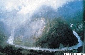
1) Yarlung Zangbo River basin


雅鲁藏布江流域
1.
Variations of δ~(18)O in Precipitation of the Yarlung Zangbo River Basin;


雅鲁藏布江流域降水中δ~(18)O的时空变化
2.
Changes of NDVI and their relations with principal climatic factors in the Yarlung Zangbo River Basin;
雅鲁藏布江流域NDVI变化与主要气候因子的关系
3.
Trends in Daily Temperature and Precipitation Extremes over the Yarlung Zangbo River Basin during 1961-2005
近45年雅鲁藏布江流域极端气候事件趋势分析
2) Yarlung Tsangpo River Basin


雅鲁藏布江流域
1.
Spatial-temporal Changes of NDVI and Their Relations with Principal Climatic Factors in Yarlung Tsangpo River Basin s Stations;
雅鲁藏布江流域NDVI时空分布及与站点气候因子的关系
3) Yaluzangbu River


雅鲁藏布江
1.
Cause analysis of environmental hazards in the middle reaches of Yaluzangbu River in Tibet;
西藏自治区雅鲁藏布江中游地区环境灾害成因分析
2.
The reproductive activities of Glyptosternum maculatum were investigated in the Yaluzangbu River in Tibet, China from September 2002 to August 2003.
研究了西藏雅鲁藏布江中的黑斑原鮡个体生殖力及其与生物学指标的关系。
4) Yarlung Zangbo River


雅鲁藏布江
1.
Application of a Distributed Hydrological Model for the Yarlung Zangbo River and Analysis of the River Runoff;
雅鲁藏布江流域的分布式水文模拟及径流变化分析
2.
Characteristics and Driving Factors of the Runoff Variations in the Yarlung Zangbo River;


雅鲁藏布江径流演变规律及其驱动因子分析
3.
Deposition Features and Causes of Loess in Yarlung Zangbo River Valley Area;


雅鲁藏布江河谷黄土的沉积特征及成因
5) Yalu Tsangpo river


雅鲁藏布江
1.
The phytogeographical affinities and florisitic nature of the big bend gorge (tropical and subtropical mountainous region below 2 500 m) of the Yalu Tsangpo River,S.
中国西藏墨脱雅鲁藏布江大峡湾河谷地区(海拔2500m以下热带亚热带山地)属东喜马拉雅山地的一部分,在区系亲缘上属印度东北部阿萨姆喀西山和那加山以及尼泊尔等东喜马拉雅地区区系的一部分;其热带成分与我国云南南部的西双版纳也有较为密切的联系,这是第三纪以来印度-马来成分沿中南半岛迁移和交流的结果。
6) the Yarlung Zangbo River


雅鲁藏布江
1.
Investigation and Assessment of the Terrestrial Vegetation in the Middle Reaches of the Yarlung Zangbo River in Tibet;
西藏雅鲁藏布江中游陆生植被调查与评价
2.
Characteristics of runoff variation in the Yarlung Zangbo River basin;


雅鲁藏布江流域径流特性变化分析
补充资料:雅鲁藏布江
| 雅鲁藏布江 世界上海拔最高的大河。位于西藏自治区南部。“雅鲁藏布”藏语意为“高山流下的雪水”。正源杰马央宗曲,源头海拔5590米,由喜马拉雅山脉中段北坡的一系列冰川融水汇成,在桑木张汇合南源库比藏布以后,向东流到萨嘎县的里孜,这一段称马泉河。从杰马央宗冰川的末端至里孜为上游段,河段长268千米,谷地开阔,河床比降小,水流平稳,江心洲和汊河发育,两岸有大片沼泽地分布。从里孜到派乡为中游段,河段长1293千米,两岸支流众多,主要有年楚河、拉萨河、尼洋河等,中游河段呈宽窄相间,水面宽100~200米,江中多沙洲,浅滩和汊流,曲水至泽当段,舟楫往来频繁,航运相当便利。派乡到巴昔卡附近为下游段,河段长496千米,河流在米林县里龙附近开始逐渐折向东北流,经派乡转为北东向,至帕隆藏布汇入后,急转南下,进入著名的底项大峡谷,河床下切2300多米,为世界上最大峡谷之一。出山口经巴昔卡流入印度,称布拉马普特拉河,进入孟加拉国称贾木纳河,注入印度洋的孟加拉湾。居中国段雅鲁藏布江全长2057千米,流域面积24.05万平方千米。水资源丰富,年径流量1400多亿立方米,径流年际变化幅度小。干流水力资源蕴藏量7611.6万千瓦,主要集中在下游底项峡谷区。
|
说明:补充资料仅用于学习参考,请勿用于其它任何用途。
参考词条
