1) the regions around Qinghai Lake

环青海湖地区
1.
Management approaches of ecological and environmental restoration in the regions around Qinghai Lake;
环青海湖地区生态与环境恢复治理途径
2.
The Three River Sources areas and the regions around Qinghai Lake are the two important ecosystems in Qinghai Province.
根据青海省"三江源地区"和"环青海湖地区"典型生态区域1987-2004年代表性牧草观测站植被监测资料和地面气象数据,结合NOAA/AVHRR卫星遥感数据以及调查数据,分析了两区域十几年来草地退化特征。
3) the peripheral area of the Qinghai Lake
环青海湖区
1.
The ecological environment in the peripheral area of the Qinghai Lake has degenerated and the area of the desertified lands has been enlarged since 1956.
环青海湖区沙漠化土地总面积 16 95 。
4) area of Qinghai lake
青海湖地区
1.
Collected 14 plants of dominant species from the downstream district of Shaliu river of area of Qinghai lake, the content of As, Sb, Pb, Cd, Ni, Co, Cr, Se, etc of 8 heavy mental element in the plants was determined by AAS.
对青海湖地区沙柳河下游地区14种典型植物,采用AAS进行了As、Sb、Pb、Cd、Ni、Co、Cr、Se等8种重金属元素含量的分析。
5) Qinghai lake region
青海湖地区
1.
[Objective] The purpose was to analyze nutritional components of six dairy products collected from Qinghai lake region.
[目的]分析青海湖地区6种乳制品的营养成分。
2.
Unreasonable human activities have resulted in serious damage of ecological environment in Qinghai lake region.
人类不合理的生产经营活动使青海湖地区生态环境遭到严重破坏 ,有数百条小河小溪已不复存在 ,湖水深由2 0世纪初的 3 7 5m下降到现在的 2 5 3m ,1963~ 1996年的 3 3年间单位面积的鲜草产量下降了 3 7 4 %。
6) Qinghai Lake area
青海湖地区
1.
Study on comparison of moderate and heavy degraded community of Kobresia capillifolia grassland around Qinghai Lake area;
青海湖地区线叶嵩草型中度与重度退化草地群落的比较研究
2.
Studies on underground biomass of moderate degradation of Kobresia capillifolia grassland in Qinghai Lake area;
青海湖地区中度退化线叶嵩草型草地地下植物量的研究
3.
Comparative research on the influence of chemical fertilizer application and enclosure on alpine steppes in the Qinghai Lake areaⅠ Structure and species diversity of the plant community;
施肥和围栏封育对青海湖地区高寒草原影响的比较研究 Ⅰ群落结构及其物种多样性
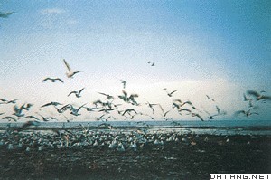
补充资料:青海湖
| 青海湖 中国最大的咸水湖。位于青海省东部。古称西海,蒙古语叫做库库诺尔,藏语叫错温布,即青色海的意思 。四周为群山环绕,湖面海拔3196米,湖水面积4583平方千米。湖水平均深度18.6米,最大深度28.7米,蓄水量854.4亿立方米,入湖大小河流有30余条,其中位于湖西的布哈河是最大的入湖河流,占有入湖总径流量的2/3左右,由于青海湖地处内陆高原,气候寒冷干燥,为典型的大陆性气候,入湖河流多为间歇性河流。补给水量减少导致湖泊水位下降,湖面缩小和湖水含盐量不断增加。青海湖是构造断陷湖。形成初期原是一个大淡水湖泊,那时气候温和多雨,湖水通过东南部的倒淌河泄入黄河,是一个外流湖。以后由于地壳运动,湖东部的日月山、野牛山迅速上升,堵塞了青海湖外泄通道,遂演变成了闭塞湖。加上气候变干,青海湖也由淡水湖逐渐变成咸水湖。
青海湖的鱼类极单纯,经济鱼类仅青海湖裸鲤一种。年产量约4000吨,青海湖已成为西北地区重要水产基地。湖中的沙岛、海心山、海西山、鸟岛和三块石等岛屿,栖息着众多的候鸟,如斑头雁等,1975年建立青海湖鸟岛自然保护区。 |
说明:补充资料仅用于学习参考,请勿用于其它任何用途。
参考词条