1) virtual geo-environments

地学虚拟环境
1.
Based on the description of the characteristic of WebGIS and the technique of virtual geo-environments, this paper develops a research of the application of WebGIS in virtual geo-environments.
在介绍了WebGIS和地学虚拟环境技术特征的基础上,研究了WebGIS技术在地学虚拟环境中的应用。
2) Virtual geographic environments
虚拟地理环境
1.
Virtual Geographic Environments Oriented 3D Visualization System;
虚拟地理环境三维可视化系统构建(英文)
2.
This paper discusses the design and construction of digital campus system of USTS based on virtual geographic environments.
阐述了基于虚拟地理环境的苏州科技学院数字校园系统的设计和建设,重点研究探讨了系统开发流程、系统体系结构、原始数据准备和三维建模等技术和方法;介绍了本系统的主要功能,为进一步建设数字城市提供了有益的参考和借鉴。
3.
Visualization of large scale terrain is playing a key role in the study of 3-D GIS 、 virtual reality and virtual geographic environments.
大规模地形可视化在三维地理信息系统、虚拟现实以及虚拟地理环境系统中占有重要地位。
3) virtual geographic environment
虚拟地理环境
1.
Application of Grid Technology in Virtual Geographic Environment;
网格技术在虚拟地理环境中的应用研究
2.
Some Thoughts on Virtual Geographic Environments;
关于虚拟地理环境研究的几点思考
3.
Study on the Network Architecture of Virtual Geographic Environment based on P2P;
基于对等结构的虚拟地理环境系统研究
4) virtual geographical environment
虚拟地理环境
1.
Research on Visual Expression Method of Temporal Information in Virtual Geographical Environment;
虚拟地理环境中时态信息可视化表达方法研究
2.
The distributed integration of geographical models is one of the main objectives of the virtual geographical environment.
地理模型分布式集成是虚拟地理环境研究的主要内容之一。
3.
This paper explains the concept of virtual geographical environment,and introduces its characteristic and the key technology in the application of virtual geographical environment technology on the practice of geographical researching and teaching in university.
从虚拟现实引入虚拟地理环境概念,介绍了虚拟地理环境具有的特征和虚拟地理环境在高校地理学中应用的关键技术。
5) virtual terrain environment
虚拟地形环境
1.
This paper simply introduces the theory of spatial cognition in virtual terrain environment,and discusses in aspects of multi-sense channels spatial cognition,interaction,and the factors influenced spatial cognition efficiency,etc.
虚拟地形环境是一个由计算机生成的以视觉感受为主,包括听觉、触觉可感知的综合模拟系统。
2.
In virtual terrain environment based on large scale map,because of the needs of nearness to view-point and all kinds of requeries and analysis,it is required to represent exactly terrain characters and make accurate fusion between ground features and terrain in order to meet observation and positioning.
以大比例尺地图构建的虚拟地形环境,由于观察视点的接近以及应用中对各种查询和分析的需要,所以要求构建的环境既能准确地表现地形特征又能使地物与地形精确融合,准确地查询出地物的属性,以满足目视及精确定位的要求。
6) Virtual expression of ancient geographic environment
古地理环境虚拟
补充资料:环境地学
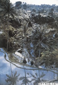
| 环境地学 environmental geoscience 以人-地系统为对象,研究其发展、组成和结构、调节以及控制、改造和利用的科学。环境科学的一个分支。随着人类的发展,人类活动的范围向下已进入地壳深处,向上已进入近地空间。所以广义地说,人-地系统可认为是人类和地球构成的系统。环境地学的孕育过程很早,18世纪在地理学中出现了人地关系学派,提出了和景观,图为印度尼西亚巴厘岛梯田景观地理环境决定论。19世纪后期,V.布拉什提出了可能论取代决定论,他的学生J.布吕纳在其《人地学原理》一书中,阐述了人地相关的原理,指出环境对人类的发展提供了各种可能性,人类则根据自己的意志选用这种可能性。第二次世界大战后,随着经济、技术的高度发展,出现了资源危机、环境污染等严重社会问题,从而推动人地关系研究的进一步发展,20世纪60年代出现了环境地学。
环境地学研究的内容和学科体系尚未完全定型,较为明确的分支学科有:环境地质学,主要研究人类活动和地质环境的相互关系;环境地球化学,主要研究人类赖以生存的地球环境的化学组成、化学作用、化学演化及其与人类相互关系;环境气象学,主要研究大气运动引起的污染物扩散、输送、迁移和转化过程,以及大气污染对天气和气候变化的影响;环境水文学,主要研究污染物在水圈中的含量、组成、状态、转化和运动规律及其对生态系统、人体健康的影响;环境土壤学,主要研究人类活动引起的土壤环境质量变化及其对人体健康、生态系统、社会经济的影响,探索调控和改善土壤环境质量的途径和方法。 |
说明:补充资料仅用于学习参考,请勿用于其它任何用途。
参考词条