1) China surface air temperature

我国各区的地面气温
2) China air temperature
我国区域气温
4) district
[英]['dɪstrɪkt] [美]['dɪstrɪkt]
n.地区,行政区;美国各州的众议院选区
5) Surface air temperature
地面气温
1.
The possible changes of surface air temperature and precipitation as well as uncertainties of the Global Climate Models(GCMs)-based projection under IS92a GG scenario just considering the greenhouse gases(GHGs)warming effects,IS92a GS scenario with consideration of combined GHGs effects and sulphate radiation effects and the SRES A2 and B2 scenarios in the 21st century had been analyzed.
利用多个全球气候模式(GCM)的情景模拟结果分析只考虑温室气体效应的IS92a GG情景和同时考虑温室气体效应和硫化物气溶胶辐射效应的IS92aGS情景以及SRESA2、B2情景下宁夏区域21世纪地面气温和降水量的可能变化,并进行不确定性分析。
2.
Anomalous variations of wintertime surface air temperature (WSAT) over the Asian continent and the relationship between WSAT and Asian winter monsoon are first examined by using empirical orthogonal function (EOF) and correlation analysis.
作者用EOF方法分析了亚洲冬季地面气温的时空特征,发现第二模态表明东北亚和南亚地区的地面气温有反相变化的特征并具有明显的年代际变化。
3.
The monthly averaged precipitation and surface air temperature produced by 5 Coupled Ocean-Atmosphere Global Climate Models (AOGCM) are compared to the observation in order to access AOGCMs abilities in simulating regional climate in East Asia.
分析了CGCM1、CSIROMK2、ECHAM4、HadCM2和GFDL共 5个海气耦合模式模拟的东亚地区地面气温和降水量的多年平均值 ,并与观测值进行了比较 ,以初步考察全球模式对区域气候的模拟能力。
6) surface temperature
地面气温
1.
and the winter surface temperatures in China,we find that there are significant simultaneous correlations between the Eurasian and West Pacific patterns,and the surface temperature anomalies in eastern China,and that there is a significant lag correlation between the West Pacific pattern in December and the surface temperature in eastern China in January.
分析Wallace等指出的冬季500hPa5个遥相关型与中国气温的关系得出:欧亚型和西太平洋型与我国东部地面气温同期相关显著;12月西太平洋型与1月中国东部气温非同期相关显著,可作为1月气温预报的依据。
2.
Based on the observed monthly surface temperature and daily precipitation of 550 stations in China from 1961 to 2000,and the surface temperature and precipitation simulated by 13 IPCC AR4(the fourth assessment report of the intergovernmental panel on climate change) models and their multi-model ensemble(MME) mean,the simulation abilities of the 13 models are evaluated.
利用中国区域550个站点逐日地面气温及降水资料,评估了参与政府间气候变化专门委员会第四次报告(the fourth assessment report of the intergovernmental panel on climate change,IPCCAR4)的13个新一代全球气候系统模式及多模式集合对中国近40 a(1961—2000年)地面气温和降水的模拟能力,结果表明:最新全球模式对中国地区地面气温年变化及空间分布的模拟结果均较好,但在整个模拟区域地面气温模拟值系统性偏低,东部地区模拟效果好于中西部;对于降水,大部分模式能模拟出中国降水的年变化及空间分布特征,但模拟的区域性差别较大,多数模式对中国东部季风区夏季雨带北抬的过程有一定的模拟能力,但模拟雨带位置偏北。
补充资料:我国省级行政区标志性建筑
01北京 天安门

02上海 东方明珠塔、金茂大厦

03天津 天塔

04重庆 解放碑

05河北-石家庄

06山西-太原 邮政大厦

07内蒙古-呼和浩特 金刚座舍利宝塔

08辽宁-沈阳 沈阳故宫

09吉林-长春 南湖四亭

10黑龙江-哈尔滨 索非亚教堂

11江苏-南京 玄武门

12浙江-杭州 雷锋塔

安徽-合肥 假日酒店及大东门寿春路桥

福建-福州 白塔

江西-南昌 滕王阁

16山东-济南 泉城广场

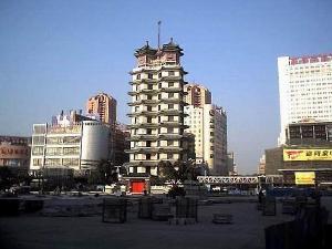
17河南-郑州 二·七纪念塔
18湖北-武汉 黄鹤楼

19湖南-长沙 岳麓书院
20广东-广州 中信广场

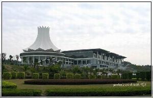
广西-南宁 国际会展中心
22海南-海口 世纪大桥

23四川-成都 廊桥

24贵州-贵阳 甲秀楼

25云南-昆明 东寺塔

陕西-西安 钟楼

甘肃-兰州 黄河第一桥---中山桥

青海-西宁 东关清真大寺

29宁夏-银川 鼓楼

30西藏-拉萨 布达拉宫

31新疆-乌鲁木齐 国际大巴扎

32香港 中银大厦

33澳门 大三巴牌坊

34台湾-台北 圆山大饭店、101大厦