1) three-dimensional map

三维地图
1.
This article first introduced the traditional three-dimensional map symbolic representation method,in this foundation,has carriedon the elaboration to the digital three-dimensional map characteristic and the mark constitution element,finally,introduced in the currentdigital charting commonly used detail level model (LOD).
该文首先介绍了传统地图的三维符号表示方法,在此基础上,对数字三维地图的特点和符号构成元素进行了阐述,最后,介绍了当前数字制图中常用的细节层次模型(LOD)。
2) 3D relief map
三维地形图
1.
The rebuilded 3D relief maps fit the law of contour,rebuild quickly and that are distinctly and beautifully.
论述军事地图的等高线生成三维地形图的一种实现方法。
3) D underground map
地下三维地图
1.
One of them is to develop the urban 3-D underground map theoretically and practically.
城市面临的环境问题和灾害减轻问题 ,都要求发展城市地下三维地图的科学基础。
4) three dimensional geomorphologic image
三维地貌影像图
5) three dimensional geological map
三维效果地质图
6) 3D electronic map
三维电子地图
1.
The study provides some experiences for the further research in 3D electronic mapand other relevant technologies.
以OpenGL技术为基础,应用支持动态显示的相关技术:多分辨率地形模型技术(LOD)、动态场景装载技术(DOL)、大面积数据管理等技术、地物三维显示的相关技术(目标剔除技术、Instance技术、M ip-M ap纹理贴图),对三维电子地图的技术实现进行了实践,为三维电子地图的进一步研究以及相关技术的研究提供了可以借鉴的经验。
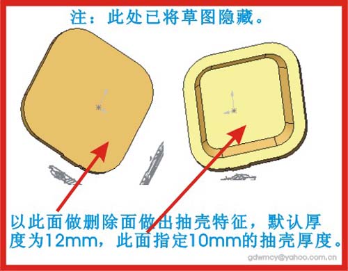
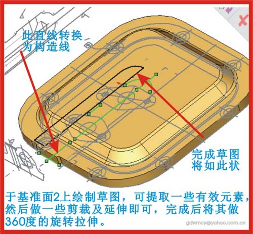
补充资料:AutoCAD二维文件转化成solidworks三维文件
图1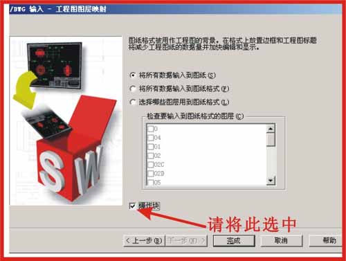
图2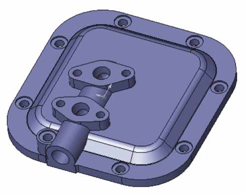
图3
图4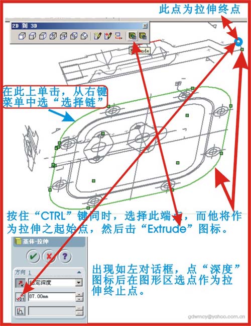
图5
图6
图7
|
说明:补充资料仅用于学习参考,请勿用于其它任何用途。
参考词条