1) instantaneous sea surface height

瞬时海面高模型
1.
The positioning problem has been solved on land by now, but no one instantaneous sea surface height model (ISS) has been developed.
就目前而言,陆地上已初步解决定位问题,但海面上却没有一种高精度瞬时海面高模型可供使用。
2) instantaneous sea level
瞬时海面
1.
Mathematic models of instantaneous sea level for single,double,threeand more tide stations are discussed respectively in this paper.
讨论了点邻域、断面及区域瞬时海面数学模型的建立。
3) sea level height model
海面高模型
4) regional instantaneous sea level
区域瞬时海面
1.
The numerical test results show that the new method can reveal the time-space variation of water level,and the seamless joining of regional instantaneous sea level can be realized.
应用结果表明,该模型准确地再现了时变水位场,实现了区域瞬时海面的无缝拼接,较好地解决了多波束条带采用传统潮汐分区改正模型引起的断层及锯齿状问题。
6) time variations of sea surface level
时变海面高
1.
On the basis of multi-altimeter data,new valid collinear and crossover adjust method are used to reduce radial orbital error and the time variations of sea surface level;the new NAO99B oceanic tide model is also used to improve the precision of the data.
利用新的海潮模型(NAO99B)更为合理的共线方法和交叠平差技术,有效改善了ERM数据的径向轨道误差和时变海面高的影响,提高了浅海海域测高数据的测高精度。
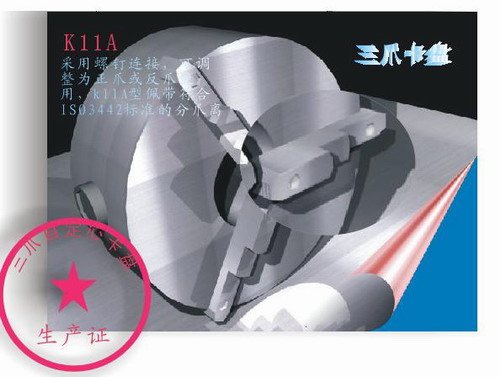
补充资料:AutoCad 教你绘制三爪卡盘模型,借用四视图来建模型
小弟写教程纯粹表达的是建模思路,供初学者参考.任何物体的建摸都需要思路,只有思路多,模型也就水到渠成.ok废话就不说了.建议使用1024X768分辨率
开始
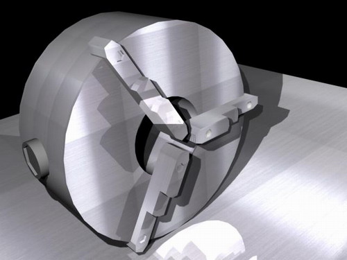
先看下最终效果
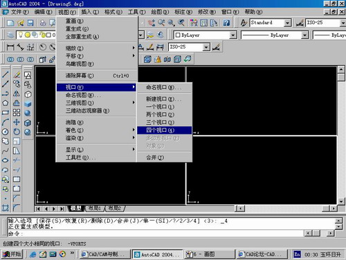
第一步,如图所示将窗口分为四个视图
第二步,依次选择每个窗口,在分别输入各自己的视图
第三步,建立ucs重新建立世界坐标体系,捕捉三点来确定各自的ucs如图

第四步,初步大致建立基本模型.可以在主视图建立两个不同的圆,在用ext拉升,在用差集运算.如图:
第五步:关键一步,在此的我思路是.先画出卡爪的基本投影,在把他进行面域,在进行拉升高度分别是10,20,30曾t形状.如图:
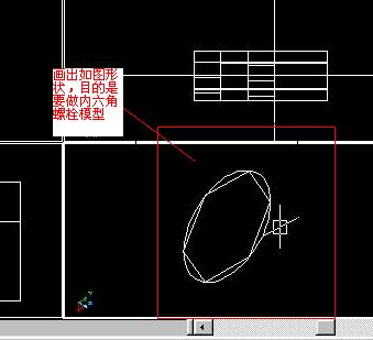
第六步:画出螺栓的初步形状.如图
第七步:利用ext拉升圆,在拉升内六边形.注意拉升六边行时方向与拉升圆的方向是相反的.
之后在利用差集运算
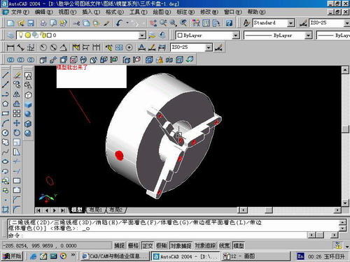
第八步:将所得内螺栓模型分别复制到卡爪上,在利用三个视图调到与卡爪的中心对称.效果如图红色的是螺栓,最后是差集
第九步:阵列
第10步.模型就完成了
来一张利用矢量处理的图片
说明:补充资料仅用于学习参考,请勿用于其它任何用途。
参考词条