1) soil map making

土壤图的绘制
2) soil utilization map making
土壤利用图的绘制
3) soil mapping
土壤绘图
4) soil mapping
土壤制图
1.
Soil mapping based on quantitative soil-landscape model has been studied all over the world.
以土壤-景观定量模型为基础的土壤制图方法在世界范围内得到了广泛研究。
2.
Extraction of Quantitative Relationships between Soil Properties and Landscape Factors Based on Fuzzy Set Theory and Its Applications in Digital Soil Mapping;
然而传统的土壤制图是基于多边形的图形表达和手工完成的过程。
5) air survey for soil maps
空中绘测土壤图
6) cartography of soil
土壤制图学
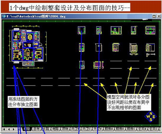
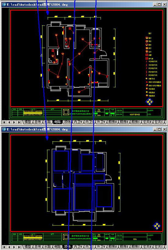
补充资料:1个dwg中绘制整套设计及布图技巧
这实际上就是建立好一套设计模板,在这个模板中已经积累完成所有需要的图块,以便快速设计——俺从来不用快捷键,具备这样的技巧便是速度~呵呵

说明:补充资料仅用于学习参考,请勿用于其它任何用途。
参考词条